Free Inquiry 4: Cadboro Bay
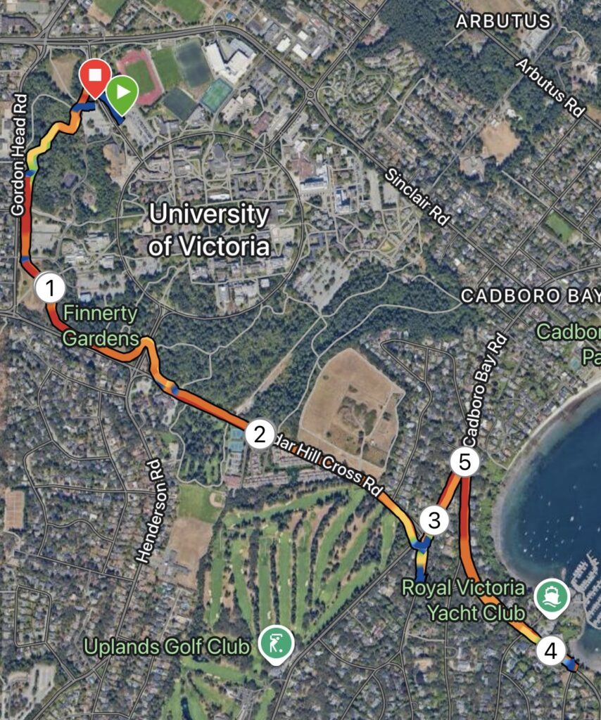
Map: This week’s route started and ended on campus, following a portion of the Alumni Chip Trail Loop before moving to Cedar Hill X Rd and Cadboro Bay Rd all the way to to the Royal Victoria Yacht Club. Shown left is a Satellite map overlayed by a speed heatmap, also depicting km markers.
Terrain: Overall, approximately 60-70% of this route was road base, with the remaining 40-30% covering gravel and chip trails. The majority of the road base sections included a separate pedestrian path or sidewalk, with the exception of a very short section on Cadboro Bay road.
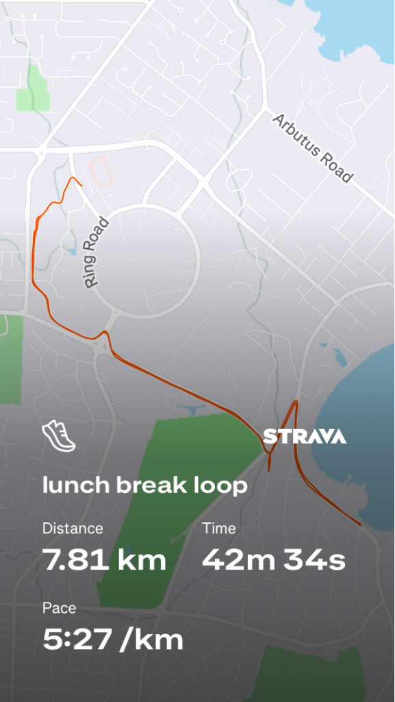
Distance/Elevation: The total distance of this route was 7.81km, totaling to a moving time of just over 40 minutes, following an out-and-back style with a few short hills. Total ascent for this route was 86m, while descent was 80m, with a max elevation of 82m.
An Honest and Thorough Review: Overall, this route is a very do-able lunch break route. The campus trail and Cadboro Bay sections provide decent weather coverage, in contrast to Cedar Hill X Rd, which is simply exposed. Cadboro Bay Rd itself has multiple beautiful beach accesses which provide nice turnaround points or break spots, if this route was incorporated into a long run. The traffic was lightly heavy at crosswalks, likely due to the time of day the route was completed, and there was a significant amount of construction along Cadboro Bay. I would probably do this route again solo, but would avoid presenting it as a candidate for group runs given the limited space on sidewalks and heavier traffic mid-day.
Rating: 3.5/5
Media: I did not have my phone with me this week and therefore do not have any photos of the specific route, but next time you’re driving or walking along Cadboro Bay or Cedar Hill X Rd… consider stopping for a jog 🙂