Free Inquiry 4: Cadboro Bay
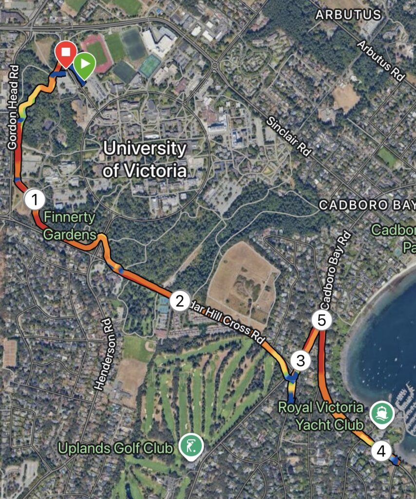
Cadboro Bay route map showing satellite map overlayed by speed heat map and km markers

Map: This week’s route started and ended on campus, following a portion of the Alumni Chip Trail Loop before moving to Cedar Hill X Rd and Cadboro Bay Rd all the way to to the Royal Victoria Yacht Club. Shown left is a Satellite map overlayed by a speed heatmap, also depicting km markers.

Terrain: Overall, approximately 60-70% of this route was road base, with the remaining 40-30% covering gravel and chip trails. The majority of the road base sections included a separate pedestrian path or sidewalk, with the exception of a very short section on Cadboro Bay road.
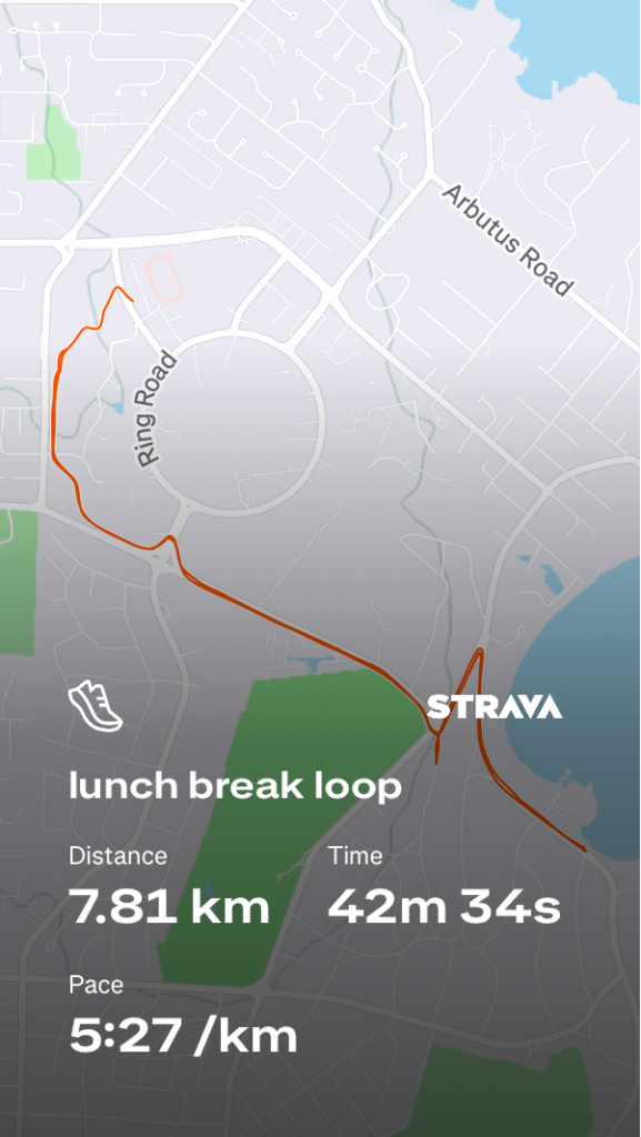
Distance/Elevation: The total distance of this route was 7.81km, totaling to a moving time of just over 40 minutes, following an out-and-back style with a few short hills. Total ascent for this route was 86m, while descent was 80m, with a max elevation of 82m.

An Honest and Thorough Review: Overall, this route is a very do-able lunch break route. The campus trail and Cadboro Bay sections provide decent weather coverage, in contrast to Cedar Hill X Rd, which is simply exposed. Cadboro Bay Rd itself has multiple beautiful beach accesses which provide nice turnaround points or break spots, if this route was incorporated into a long run. The traffic was lightly heavy at crosswalks, likely due to the time of day the route was completed, and there was a significant amount of construction along Cadboro Bay. I would probably do this route again solo, but would avoid presenting it as a candidate for group runs given the limited space on sidewalks and heavier traffic mid-day.

Rating: 3.5/5

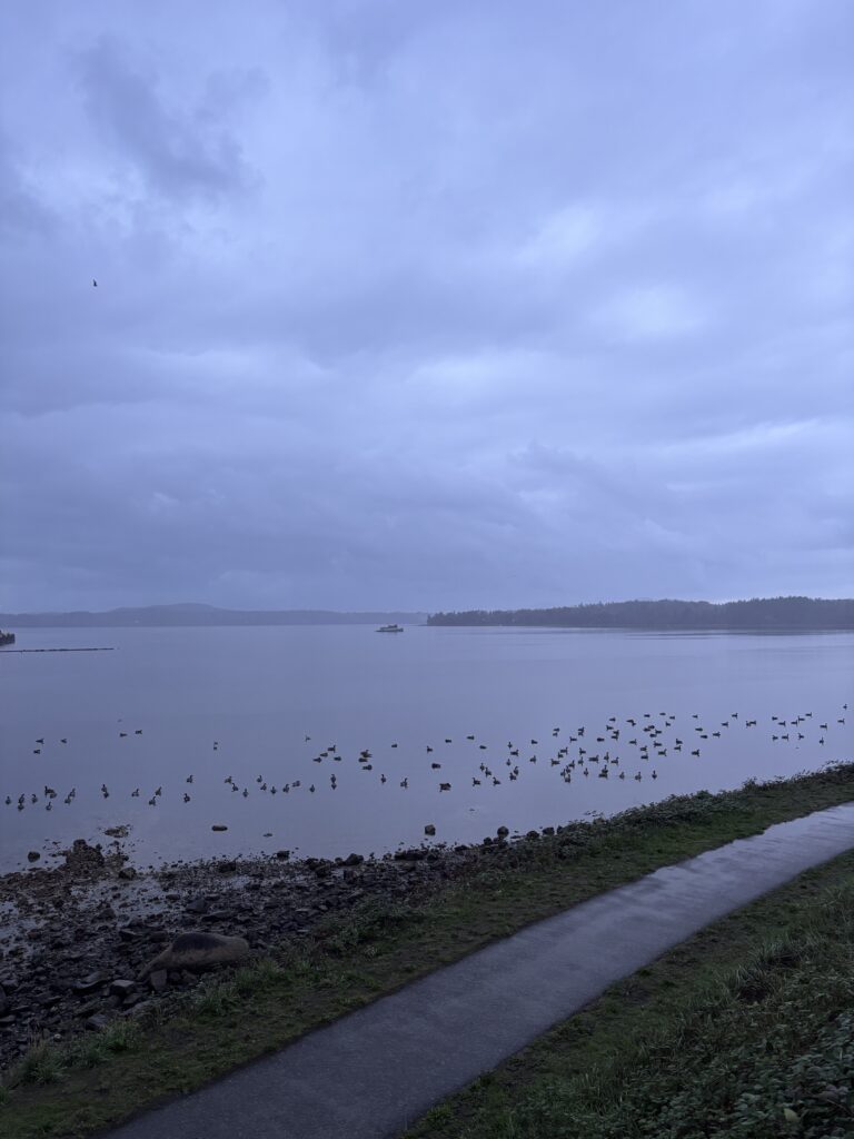
Media: I did not have my phone with me this week and therefore do not have any photos of the specific route, but next time you’re driving or walking along Cadboro Bay or Cedar Hill X Rd… consider stopping for a jog 🙂
Free Inquiry 3: Dallas Rd

One of the primary reasons driving my route boredom is that the majority of my runs are completed within the same 21km radius of my house (or so). Luckily, my training group is based in Oak Bay, which has provided ample opportunity for me to explore new routes with friends. Recently, we completed our interval work along Dallas Rd. Though I have walked along the breakwater many times, I neglected to realize it’s high potential for group interval training.

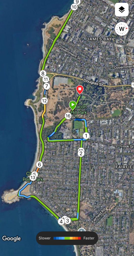
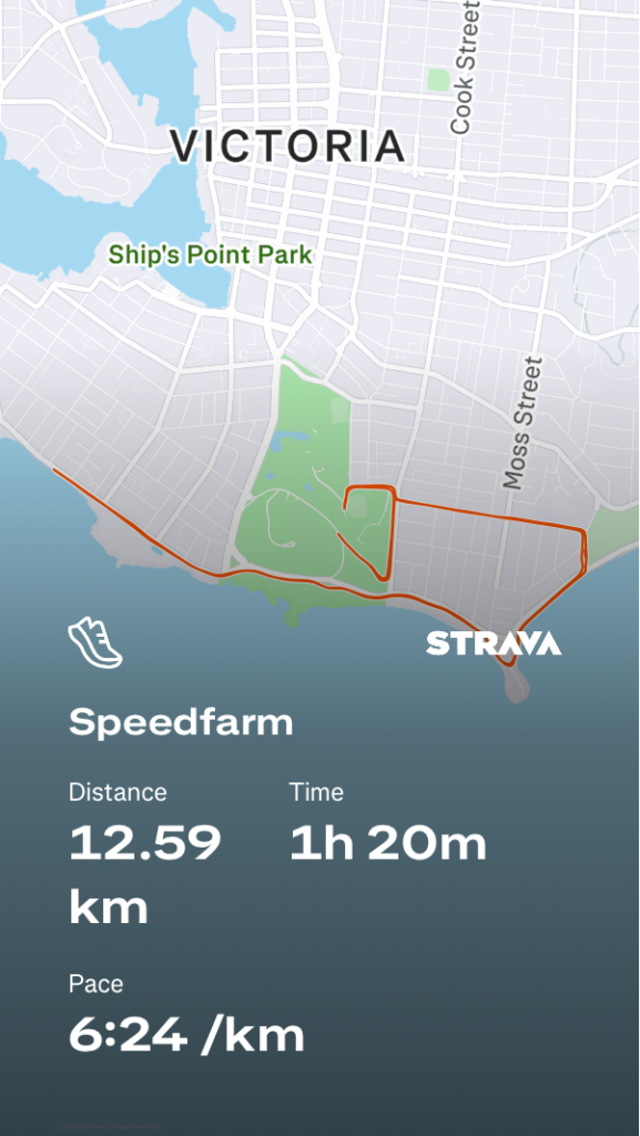
Map: This route began at Beacon Hill Park and included a couple kilometers of warm up towards Dallas Rd, before following the length of Dallas Rd, extending all the way to the breakwater bridge. Shown right is the satellite map, overlayed by a heatmap depicting speed changes throughout the numbered intervals, and the turn-around point on Dallas Rd shown between intervals 9 and 10.

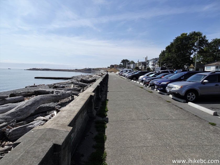
Terrain: With the exception of the few cedar chip trails present during the transition between Beacon Hill Park to Dallas Rd, the entirety of this run was completed on road base (pavement). The section along Dallas Rd itself offers a separate walk/run/bike path on which we completed our intervals. The path was wide enough for us to run in trios, leaving room for other pedestrians or cyclists without obstruction. It also enabled us to run in the dark without worrying about traffic, under streetlights and in small groups.

Distance/Elevation: The total distance of this route was 12.5km, totaling to just under an hour and a half. The intervals themselves were completed along a 4-5km section of Dallas Rd and included a turn around point. The total ascent during this route was 93m, with a descent of 89m, and maximum elevation of 37m. Overall, significantly flat, providing ideal terrain for speedwork.

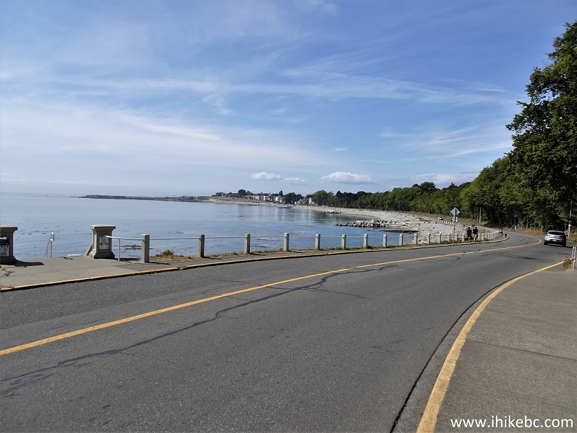
An Honest and Thorough Review: This route provided simple, easy terrain that was ideal for group training after daylight hours. Ample parking at Beacon Hill enabled all of us to start together without finding parking along Dallas Rd, however, there are also several spots at Clover Point that could be an alternative option. Traffic was minimal to non existent, given the separate pedestrian and cyclist path and the private trails through Beacon Hill Park. This route is exceptionally scenic, with a five-star view of the Olympic mountains during daylight hours, and a peaceful view of the Victoria Harbour in the evening. Overall, I would say this route is a stellar option for group training at any time of day, regardless of daylight or traffic volumes. The only downside to this routs is its’ lack of protection from any sort of adverse weather; it directly faces rain and wind coming off the ocean.

Rating: 5/5

Media: These photos were not taken at the time of this run, but provide evidence of the daytime views and walking paths. Media was obtained from iHikeBC.

Free Inquiry 2: YYJ

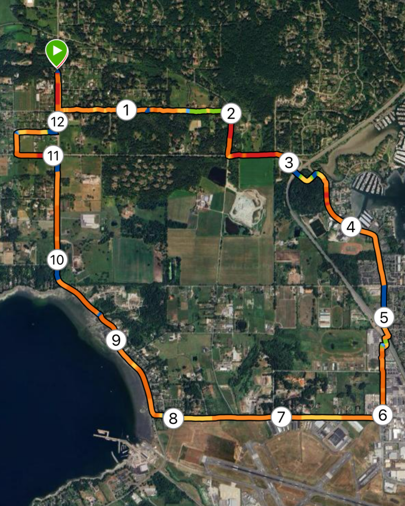
Map: This week, my route was located in North Saanich, extending from Deep Cove out towards the Victoria International Airport (YYJ). Shown left is satellite map generated by Garmin, showing km markers overlayed by a heatmap – red and orange depict flat and level terrain, while green and blue depict steeper, inclined terrain.

Terrain: The majority of this run was road base, with small sections of chip or gravel trail. With the exception of Tatlow Rd and the lower section of Wain Rd, all roads included a bike lane, providing space away from traffic.

Distance/Elevation: The total distance of this route was 12.45km, which equated to 1h6m. Total ascent across this distance was 118m, while descent was 98m, with a maximum elevation of 64m; Overall, very flat.

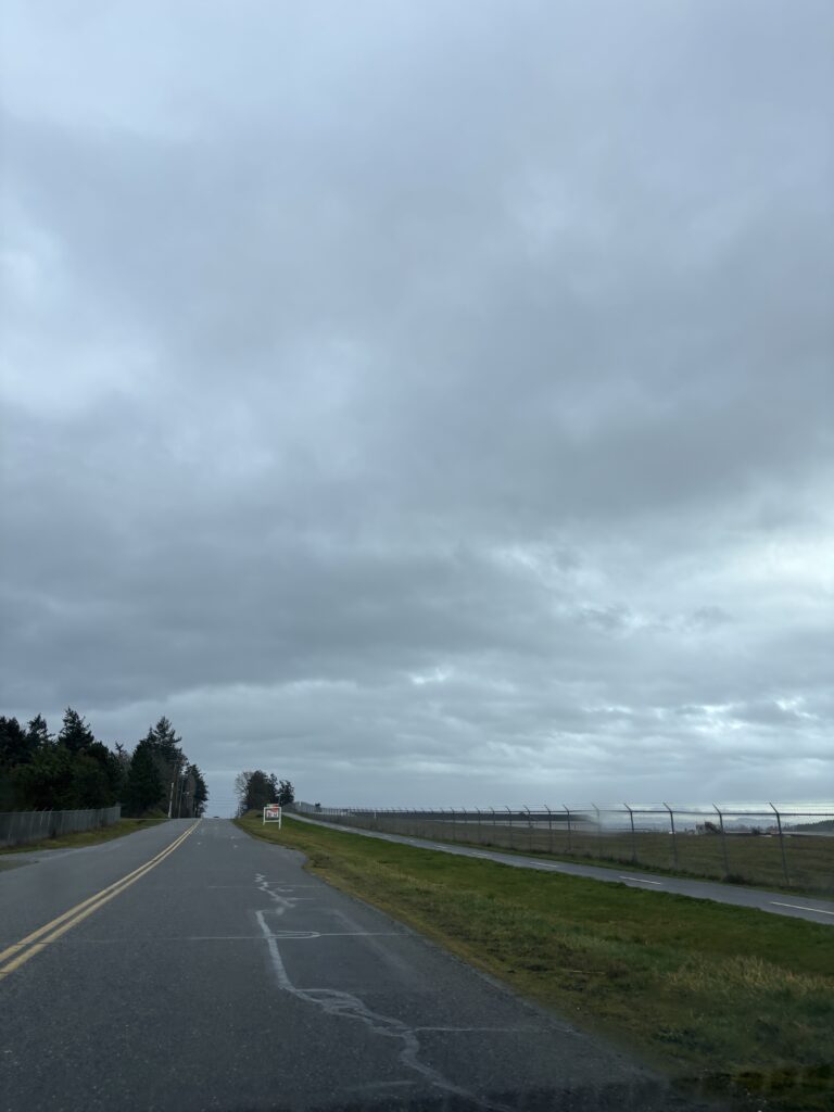
An Honest and Thorough Review: This loop provided a decent, quiet, continuous loop with moderate mileage. Though predominantly pavement, bike lanes and road shoulders helps avoid the feeling of running directly on the road or through busy traffic. I managed to go for this run around lunchtime on a weekday, which was also likely a period of low traffic since as I avoided heavy commute times. Despite not being a scenic trail, the route provided some nice views of the Sidney Harbour, Patricia Bay, and some of the local farms. Though the day I went was quite cloudy, it would also provide a fairly equal balance of sun and shade, which would be an important consideration while repeating this run in the summer months. Overall, I would say this loop is perfect for a comfortable, mid-distance run to be completed outside of rush hour. It would not be a good fit for a group session or fast-paced tempo or time trial run, given the number of crosswalks and single file bike lane or shoulder paths.

Rating: 4 /5

Media:

Free Inquiry 1: Happy Trails

I have decided to devote this semester of free inquiry to acquiring a comprehensive list of well-rated, thoroughly critiqued running routes. I have chosen the general area from Goldstream to Swartz Bay, to give myself a wide range of terrain including roads, coastal and hiking trails.

My primary goal in pursuing this project is to break my boredom and frustration with my current running routes – some of which I love, but many of which are getting old. Lately, I have found myself so stuck in my busy schedule that I simply avoid new trails without a concrete idea of how long they are, what the terrain is like, and how much shelter they offer from our ever-rainy weather. By the end of this semester, I hope to have gathered enough routes to categorize by distance, terrain, and overall experience. This leads me to my second inquiry goal, which is to be able to share this data with friends. I hope to generate something useful for others, to enable them to also explore local areas on foot, whether running or hiking. Overall, this is both a fitness and community based goal through which I hope to explore the beauty of the W̱SÁNEĆ and Lekwungen territory, and simultaneously gather useful data.

To begin, I will be using a combination of Google Maps, Strava, and AllTrails to conduct route research, and my Garmin Venu to track my routes. I will be using my phone to gather media from each route. Another great resource I will be using conduct research and build my routes from is RunVictoria, which provides several road routes from Swartz Bay to downtown, ranging from 9km or less to 17km+.

My weekly posts will look something like this:

(A photo from the route)

Map: Strava and/or Garmin map to depict chose route.

Terrain: review and classification of the route’s terrain, noting elevation, trail or road base, etc.

Distance/Elevation: km distance and m elevation statistics.

An Honest and Thorough Review: further comments on the route, including both vehicle and foot traffic, accessibility, scenic elements, flow, structure, and overall feel.

Rating: a rating out of 5, using the following scale.

1 = Poor, would not run again.

2= Adequate, not likely to be a regular run.

3= Good, few complaints, got the kms in, proposed alterations.

4= Great, would run again and recommend to a friend.

5= Fantastic, fun kms, would repeat solo and with friends!

Photos were obtained and downloaded through UnSplash.